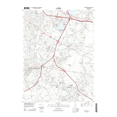
2014 Map of Morristown
USGS Topo · Published 2014About this map
The suburban and historical landscape of central Morris County is centered on Morristown, a city known for its Revolutionary War significance. This modern survey illustrates the proximity of the Morristown National Historical Park to contemporary developments such as Shady Lawn Manor and Ridgedale Park. The terrain is marked by distinctive rises like Watnong Mtn and Kinneys Hill, while water features like the Whippany River and Lake Parsippany dictate the local geography.
Find a feature on this map
66 named features on this map. Tap any name to fly to it.
Don’t see what you’re looking for? This feature index may not catch every label — zoom into the map to look around manually.
Map Details
Editions of this 2014 Morristown Map
This is the sole edition of this map. No revisions or reprints were ever made.
Other maps of this area

1888 · Plainfield
USGS Topo · 1:62,500

1888 · Morristown
USGS Topo · 1:62,500

1888 · Lake Hopatcong
USGS Topo · 1:62,500

1891 · Somerville
USGS Topo · 1:62,500

1893 · Plainfield
USGS Topo · 1:62,500

1893 · Somerville
USGS Topo · 1:62,500

1894 · Morristown
USGS Topo · 1:62,500

1894 · Lake Hopatcong
USGS Topo · 1:62,500

1898 · Lake Hopatcong
USGS Topo · 1:62,500

1898 · Morristown
USGS Topo · 1:62,500