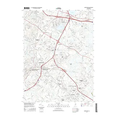
2016 Map of Morristown
USGS Topo · Published 2016About this map
Morristown National Historical Park anchors the southwestern quadrant of this Morris County study, preserving the landscape where the Continental Army wintered during the Revolutionary War. The region is defined by a dense network of suburban villages and mid-century residential developments, including Morris Plains, Whippany, and Florham Park. This era shows the mature integration of major transit corridors like I-287 and I-80 with the area's older topography, where the Whippany River and Troy Brook once drove early industry. Large institutional footprints are prominent throughout, from the campus of Drew University to the Morristown Municipal Airport. Between these hubs, historic cemeteries like Holy Rood Cem and Saint Marys Cem remain as physical links to the genealogy of local families in long-established communities such as Littleton and Cedar Knolls.
Find a feature on this map
69 named features on this map. Tap any name to fly to it.
Don’t see what you’re looking for? This feature index may not catch every label — zoom into the map to look around manually.
Map Details
Editions of this 2016 Morristown Map
This is the sole edition of this map. No revisions or reprints were ever made.
Other maps of this area

1888 · Plainfield
USGS Topo · 1:62,500

1888 · Morristown
USGS Topo · 1:62,500

1888 · Lake Hopatcong
USGS Topo · 1:62,500

1891 · Somerville
USGS Topo · 1:62,500

1893 · Plainfield
USGS Topo · 1:62,500

1893 · Somerville
USGS Topo · 1:62,500

1894 · Morristown
USGS Topo · 1:62,500

1894 · Lake Hopatcong
USGS Topo · 1:62,500

1898 · Lake Hopatcong
USGS Topo · 1:62,500

1898 · Morristown
USGS Topo · 1:62,500