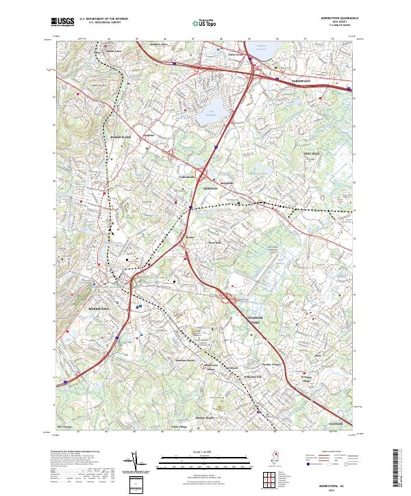
2023 Map of Morristown
USGS Topo · Published 2023About this map
The Morristown National Historical Park preserves significant open space and heritage sites within a landscape that balances suburban growth and historical continuity. Centered around Morristown and Parsippany, this map illustrates a complex network of residential developments and academic institutions, including Fairleigh Dickinson University - College at Florham and Drew University. The industrial and transportation legacy of the region is evident in the presence of the Morristown & Erie RR, while prominent water features like Lake Parsippany and the Boonton Reservoir dominate the northeastern reaches.
Find a feature on this map
399 named features on this map. Tap any name to fly to it.
Don’t see what you’re looking for? This feature index may not catch every label — zoom into the map to look around manually.
Map Details
Editions of this 2023 Morristown Map
This is the sole edition of this map. No revisions or reprints were ever made.
Other maps of this area

1888 · Plainfield
USGS Topo · 1:62,500

1888 · Morristown
USGS Topo · 1:62,500

1888 · Lake Hopatcong
USGS Topo · 1:62,500

1891 · Somerville
USGS Topo · 1:62,500

1893 · Plainfield
USGS Topo · 1:62,500

1893 · Somerville
USGS Topo · 1:62,500

1894 · Morristown
USGS Topo · 1:62,500

1894 · Lake Hopatcong
USGS Topo · 1:62,500

1898 · Lake Hopatcong
USGS Topo · 1:62,500

1898 · Morristown
USGS Topo · 1:62,500