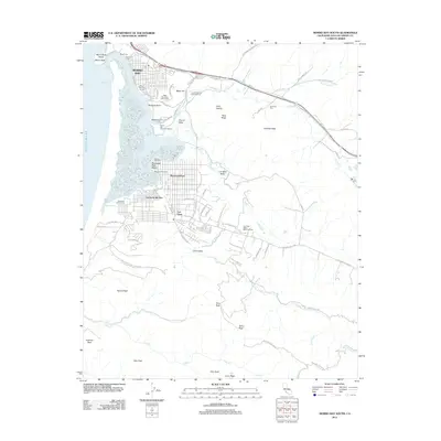
2012 Map of Morro Bay South
USGS Topo · Published 2012About this map
Morro Bay and the adjacent communities of Baywood Park, Cuesta-by-the-Sea, and Los Osos define the coastal character of this central California region. The prominent volcanic landmark of Morro Rock stands at the harbor entrance, while the extensive tidal marshes of the Chorro Delta and the waters of Shark Inlet illustrate the complex interface between the Pacific Ocean and the coastal hills. This 2012 survey captures the area's transition from residential grids to the expansive protected lands of Montana De Oro State Park.
Find a feature on this map
86 named features on this map. Tap any name to fly to it.
Don’t see what you’re looking for? This feature index may not catch every label — zoom into the map to look around manually.
Map Details
Editions of this 2012 Morro Bay South Map
This is the sole edition of this map. No revisions or reprints were ever made.
Other maps of this area

1897 · Port Harford
USGS Topo · 1:62,500

1897 · San Luis Obispo
USGS Topo · 1:62,500

1897 · Cayucos
USGS Topo · 1:62,500

1897 · Arroyo Grande
USGS Topo · 1:62,500

1900 · San Luis
USGS Topo · 1:125,000

1937 · Cayucos
USGS Topo · 1:62,500

1941 · Port San Luis
USGS Topo · 1:62,500

1942 · San Luis Obispo
USGS Topo · 1:62,500

1942 · Arroyo Grande
USGS Topo · 1:62,500

1943 · Cayucos
USGS Topo · 1:62,500