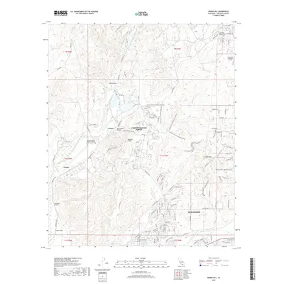
2018 Map of Morro Hill
USGS Topo · Published 2018About this map
Camp Pendleton North and the Camp Pendleton Marine Corps Air Station (Munn Field) dominate this 2018 coastal California landscape, illustrating the significant military footprint between the Santa Margarita River and the San Luis Rey River. The terrain is marked by a series of steep canyons, including Wood Canyon, Rattlesnake Canyon, and Windmill Canyon, which define the training grounds and residential areas of the base. Settlement clusters like Chappo and Jofegan are integrated into the base infrastructure, while the northeastern corner shows the edge of civilian development near the Fallbrook Community Airpark and the Fallbrook Pioneer Odd Fellows Cem. A modern recreational layer is visible through the winding course of the Hell Fire Fat Tire Mountain Bike Race, which traverses the ridges and valleys near Lake O'Neill, demonstrating how the military reservation accommodates specialized athletic events alongside its primary operations.
Find a feature on this map
132 named features on this map. Tap any name to fly to it.
Don’t see what you’re looking for? This feature index may not catch every label — zoom into the map to look around manually.
Map Details
Editions of this 2018 Morro Hill Map
This is the sole edition of this map. No revisions or reprints were ever made.
Other maps of this area

1893 · Oceanside
USGS Topo · 1:62,500

1893 · Escondido
USGS Topo · 1:62,500

1898 · Oceanside
USGS Topo · 1:62,500

1901 · Escondido
USGS Topo · 1:62,500

1901 · Oceanside
USGS Topo · 1:62,500

1901 · San Luis Rey
USGS Topo · 1:125,000

1904 · Southern California Sheet No. 2
USGS Topo · 1:250,000

1941 · Margarita Peak
USGS Topo · 1:62,500

1942 · Margarita Peak
USGS Topo · 1:62,500

1942 · Temecula
USGS Topo · 1:62,500
Featured Places
- Oceanside, CA
- Jofegan, Marine Corps Base Camp Pendleton
- Marine Corps Base Camp Pendleton, CA
- San Diego County, CA
- United States