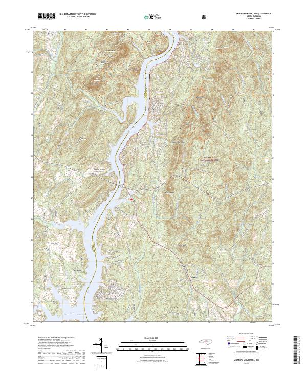
2022 Map of Morrow Mountain
USGS Topo · Published 2022About this map
The Pee Dee River carves a deep valley between the Uwharrie Mountains and the heights of Morrow Mountain, creating a landscape defined by significant elevation changes and waterfront development. Modern recreation and conservation dominate the eastern banks within the Uwharrie National Forest, while the western shore shows the growth of residential enclaves like River Haven. The southern portion of the map transitions into the waters of Lake Tillery, where the river widens near the settlement of Norwood.
Find a feature on this map
120 named features on this map. Tap any name to fly to it.
Don’t see what you’re looking for? This feature index may not catch every label — zoom into the map to look around manually.
Map Details
Editions of this 2022 Morrow Mountain Map
This is the sole edition of this map. No revisions or reprints were ever made.
Other maps of this area

1942 · Troy
USGS Topo · 1:125,000

1953 · Raleigh
USGS Topo · 1:250,000

1953 · Charlotte
USGS Topo · 1:250,000

1954 · Charlotte
USGS Topo · 1:250,000

1954 · Raleigh
USGS Topo · 1:250,000

1956 · Mount Gilead East
USGS Topo · 1:24,000

1956 · Mount Gilead West
USGS Topo · 1:24,000

1957 · Albemarle
USGS Topo · 1:62,500

1957 · Troy
USGS Topo · 1:62,500

1960 · Charlotte
USGS Topo · 1:250,000