
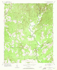
1956 Map of Mount Gilead East
USGS Topo · Published 1957About this map
State Town Creek Indian Mound Res stands as a central landmark in this mid-century survey of the Pee Dee River basin, highlighting the area's ancient indigenous history alongside rural development. The landscape is defined by the Little River and Cheek Creek, which carve through the Mount Gilead region. This era shows a dense network of country congregations, including Ingram Chapel, Mountain Grove Ch, and Snow Hill Churches, reflecting the social core of these Piedmont communities.
Find a feature on this map
42 named features on this map. Tap any name to fly to it.
Don’t see what you’re looking for? This feature index may not catch every label — zoom into the map to look around manually.
Map Details
Editions of this 1956 Mount Gilead East Map
3 editions found
Other maps of this area

1942 · Troy
USGS Topo · 1:125,000

1953 · Raleigh
USGS Topo · 1:250,000

1953 · Charlotte
USGS Topo · 1:250,000

1954 · Charlotte
USGS Topo · 1:250,000

1954 · Raleigh
USGS Topo · 1:250,000

1956 · Mangum
USGS Topo · 1:24,000

1956 · Ellerbe
USGS Topo · 1:24,000

1956 · Harrisville
USGS Topo · 1:24,000

1956 · Ansonville
USGS Topo · 1:24,000

1956 · Mount Gilead West
USGS Topo · 1:24,000