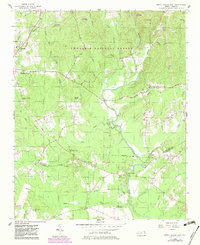
1956 Map of Mount Gilead East
USGS Topo · Published 1983About this map
The State Town Creek Indian Mound Res occupies a prominent bend in Little River, representing a significant archaeological site in the heart of North Carolina's Piedmont. This survey from the mid-1950s, with later updates, traces the rural landscape of southern Montgomery and northern Richmond counties as it transition from the Uwharrie National Forest to active agricultural and milling lands. The Norfolk Southern railroad runs through the western edge, serving the community of Mount Gilead.
Find a feature on this map
38 named features on this map. Tap any name to fly to it.
Don’t see what you’re looking for? This feature index may not catch every label — zoom into the map to look around manually.
Map Details
Editions of this 1956 Mount Gilead East Map
3 editions found
Other maps of this area

1942 · Troy
USGS Topo · 1:125,000

1953 · Raleigh
USGS Topo · 1:250,000

1953 · Charlotte
USGS Topo · 1:250,000

1954 · Charlotte
USGS Topo · 1:250,000

1954 · Raleigh
USGS Topo · 1:250,000

1956 · Mangum
USGS Topo · 1:24,000

1956 · Mount Gilead East
USGS Topo · 1:24,000

1956 · Ellerbe
USGS Topo · 1:24,000

1956 · Harrisville
USGS Topo · 1:24,000

1956 · Ansonville
USGS Topo · 1:24,000