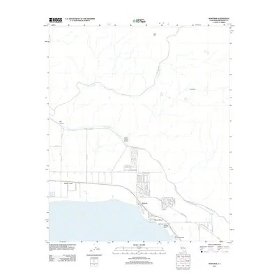
2012 Map of Mortmar
USGS Topo · Published 2012About this map
The northern shoreline of the Salton Sea meets the edge of the Colorado Desert in this 2012 survey of the North Shore area. The settlement of Mortmar and nearby Desert Beach are defined by a grid of residential streets like Corvina Dr and Mecca Ave that stop abruptly at the water's edge. This desert landscape is heavily managed by the Coachella Canal, which skirts the base of the mountains to provide irrigation and water to the valley. To the north, the terrain becomes increasingly arid and broken, marked by the deep Box Canyon Wash and the geological formation known as The Grotto. Hidden water sources like Sheep Hole Oasis and Hidden Spring highlight the locations of rare riparian pockets within the Hidden Spring Canyon and the surrounding desert wilderness.
Find a feature on this map
61 named features on this map. Tap any name to fly to it.
Don’t see what you’re looking for? This feature index may not catch every label — zoom into the map to look around manually.
Map Details
Editions of this 2012 Mortmar Map
This is the sole edition of this map. No revisions or reprints were ever made.
Other maps of this area

1904 · Indio
USGS Topo · 1:125,000

1931 · Vallecito
USGS Topo · 1:125,000

1940 · Cottonwood Spring
USGS Topo · 1:62,500

1940 · Durmid
USGS Topo · 1:62,500

1941 · Coachella
USGS Topo · 1:62,500

1942 · Agua Dulce
USGS Topo · 1:62,500

1943 · Vallecito
USGS Topo · 1:125,000

1943 · Coachella
USGS Topo · 1:62,500

1944 · Agua Dulce
USGS Topo · 1:62,500

1944 · Cottonwood Spring
USGS Topo · 1:62,500