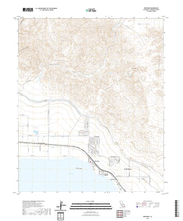
2021 Map of Mortmar
USGS Topo · Published 2021About this map
The Mecca Hills and the southern reach of the Orocopia Mountains dominate the northern landscape of this survey, cut by the deep erosional paths of Painted Canyon and Box Canyon. This arid terrain gives way to the engineering of the Coachella Canal, which skirts the base of the hills to deliver water across the desert. Along the northeastern edge of the Salton Sea, the settlements of Mortmar, Desert Beach, and North Shore reflect the mid-century development of this inland shoreline.
Find a feature on this map
73 named features on this map. Tap any name to fly to it.
Don’t see what you’re looking for? This feature index may not catch every label — zoom into the map to look around manually.
Map Details
Editions of this 2021 Mortmar Map
This is the sole edition of this map. No revisions or reprints were ever made.
Other maps of this area

1904 · Indio
USGS Topo · 1:125,000

1931 · Vallecito
USGS Topo · 1:125,000

1940 · Cottonwood Spring
USGS Topo · 1:62,500

1940 · Durmid
USGS Topo · 1:62,500

1941 · Coachella
USGS Topo · 1:62,500

1942 · Agua Dulce
USGS Topo · 1:62,500

1943 · Vallecito
USGS Topo · 1:125,000

1943 · Coachella
USGS Topo · 1:62,500

1944 · Agua Dulce
USGS Topo · 1:62,500

1944 · Cottonwood Spring
USGS Topo · 1:62,500