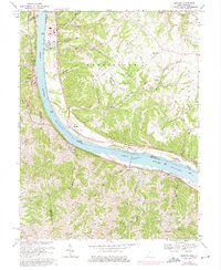
1968 Map of Moscow
USGS Topo · Published 1975About this map
Ohio River life dominates this stretch of the border between Clermont County, Ohio, and its neighbors in Bracken and Pendleton counties, Kentucky. The massive Capt Anthony Meldahl Lock and Dam stands as a central industrial landmark, shifting the river levels between Normal Pool Elev 455 and Normal Pool Elev 485. Inland, the terrain is defined by the steep dissected plateaus of Fruit Ridge, where family-named roads like Myers Road and Bolender Road connect small upland communities. Genealogists can find numerous burial sites and rural congregations, including the Moscow Cem, Neville Cem, and McKendree Ch. Along the Kentucky shore, the Chesapeake and Ohio railroad corridor tracks the riverbank through settlements like Ivor and Carntown, while the Ohio side features established river towns like Moscow, Neville, and Chilo.
Find a feature on this map
75 named features on this map. Tap any name to fly to it.
Don’t see what you’re looking for? This feature index may not catch every label — zoom into the map to look around manually.
Map Details
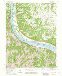
Editions of this 1968 Moscow Map
2 editions found
Other maps of this area

1929 · Alexandria
USGS Topo · 1:48,000

1930 · Falmouth
USGS Topo · 1:48,000

1931 · Felicity
USGS Topo · 1:62,500

1936 · Alexandria
USGS Topo · 1:62,500

1936 · Falmouth
USGS Topo · 1:62,500

1952 · Berlin
USGS Topo · 1:24,000

1952 · Brooksville
USGS Topo · 1:24,000

1953 · Laurel
USGS Topo · 1:24,000

1953 · Bethel
USGS Topo · 1:24,000

1953 · Butler
USGS Topo · 1:24,000