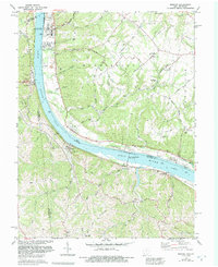
1981 Map of Moscow
USGS Topo · Published 1992About this map
The Ohio River dominates this landscape where the borders of Ohio and Kentucky meet, serving as a primary corridor for both energy and transport. The William H. Zimmer Nuclear Power Station and the massive Capt Anthony Meldahl Locks and Dam anchor the riverfront, highlighting the industrial engineering that reshaped the river's character in the late 20th century. Away from the water, the terrain rises into the dissected plateaus of Washington and Franklin townships, where family history is etched into the landscape at Vesper Cem and McKendree Cem. Small settlements like Neville, Chilo, and Willow Grove line the banks, connected by the CSX Transportation line and several local landmarks, including the Cemetery Chapel and the Landing Strip near the river's edge.
Find a feature on this map
58 named features on this map. Tap any name to fly to it.
Don’t see what you’re looking for? This feature index may not catch every label — zoom into the map to look around manually.
Map Details
Editions of this 1981 Moscow Map
2 editions found
Other maps of this area

1929 · Alexandria
USGS Topo · 1:48,000

1930 · Falmouth
USGS Topo · 1:48,000

1931 · Felicity
USGS Topo · 1:62,500

1936 · Alexandria
USGS Topo · 1:62,500

1936 · Falmouth
USGS Topo · 1:62,500

1952 · Berlin
USGS Topo · 1:24,000

1952 · Brooksville
USGS Topo · 1:24,000

1953 · Laurel
USGS Topo · 1:24,000

1953 · Bethel
USGS Topo · 1:24,000

1953 · Butler
USGS Topo · 1:24,000