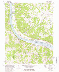
1981 Map of Moscow
USGS Topo · Published 1982About this map
The Ohio River corridor between Clermont County, Ohio, and Bracken County, Kentucky, is dominated by industrial and infrastructure landmarks in the early 1980s. The William H. Zimmer Nuclear Power Station sits prominently near Moscow, while further downstream, the Capt Anthony Meldahl Locks and Dam regulates the river's flow. These modern utilities contrast with the deeply dissected plateaus of Washington and Franklin townships, where older patterns of settlement remain visible along Fruit Ridge and Bolender Ridge.
Find a feature on this map
85 named features on this map. Tap any name to fly to it.
Don’t see what you’re looking for? This feature index may not catch every label — zoom into the map to look around manually.
Map Details
Editions of this 1981 Moscow Map
2 editions found
Other maps of this area

1929 · Alexandria
USGS Topo · 1:48,000

1930 · Falmouth
USGS Topo · 1:48,000

1931 · Felicity
USGS Topo · 1:62,500

1936 · Alexandria
USGS Topo · 1:62,500

1936 · Falmouth
USGS Topo · 1:62,500

1952 · Berlin
USGS Topo · 1:24,000

1952 · Brooksville
USGS Topo · 1:24,000

1953 · Laurel
USGS Topo · 1:24,000

1953 · Bethel
USGS Topo · 1:24,000

1953 · Butler
USGS Topo · 1:24,000