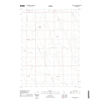
2020 Map of Mosquito Lake Butte
USGS Topo · Published 2020About this map
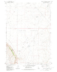
Mosquito Lake Butte and Burnt Butte rise above the high desert floor of Owyhee County, defining a landscape shaped by intermittent water and wide-ranging ranching roads. The map highlights the essential water management of the region, anchored by the Mosquito Lake Reservoir and the smaller Rattlesnake Draw Reservoir to the west. These catchments, along with the drainage of Poison Creek, provided the necessary resources for livestock and survival in an arid environment. A sparse but critical network of thoroughfares, including Clover Three Creek Rd and Post Office Rd, suggests the historical routes used to connect remote homesteads and grazing lands. The layout of these roads and the positioning of prominent landmarks like Mid Butte reveal the navigational priorities of a high-altitude plateau where seasonal water and open range dictated the patterns of human movement.
Find a feature on this map
16 named features on this map. Tap any name to fly to it.
Don’t see what you’re looking for? This feature index may not catch every label — zoom into the map to look around manually.
Map Details
Editions of this 2020 Mosquito Lake Butte Map
This is the sole edition of this map. No revisions or reprints were ever made.
Other maps of this area

1955 · Twin Falls
USGS Topo · 1:250,000

1958 · Twin Falls
USGS Topo · 1:250,000
1979 · Dishpan
USGS Topo · 1:24,000

1979 · Salls Crossing
USGS Topo · 1:24,000

1979 · Clover Butte South
USGS Topo · 1:24,000

1979 · Mosquito Lake Butte
USGS Topo · 1:24,000
1979 · Poison Butte
USGS Topo · 1:24,000
1979 · Three Creek
USGS Topo · 1:24,000
1979 · Murphy Hot Springs
USGS Topo · 1:24,000

1979 · Coonskin Butte
USGS Topo · 1:24,000