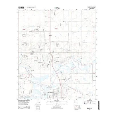
2015 Map of Moss Bluff
USGS Topo · Published 2015About this map
The Calcasieu River and its labyrinthine bayous dictate the character of this Louisiana landscape north of Lake Charles. The river's winding path creates a complex network of waterways, including Burnett Bay, Alligator Bay, and Bird Island Bay, which defined the local navigation and geography long before modern development. In the center, the community of Moss Bluff sits atop the higher ground, while the southern edge of the map shows the transition into more industrial and suburban areas near Westlake and Goosport.
Find a feature on this map
241 named features on this map. Tap any name to fly to it.
Don’t see what you’re looking for? This feature index may not catch every label — zoom into the map to look around manually.
Map Details
Editions of this 2015 Moss Bluff Map
This is the sole edition of this map. No revisions or reprints were ever made.
Other maps of this area

1932 · Lake Charles NE
USGS Topo · 1:31,680

1932 · Lake Charles NW
USGS Topo · 1:31,680

1935 · Buhler
USGS Topo · 1:31,680

1935 · Moss Bluff
USGS Topo · 1:31,680

1935 · Gordon
USGS Topo · 1:31,680

1935 · Gaytine
USGS Topo · 1:31,680

1942 · Lake Charles
USGS Topo · 1:62,500

1947 · Gaytine
USGS Topo · 1:31,680

1947 · Moss Bluff
USGS Topo · 1:31,680

1947 · Hecker
USGS Topo · 1:31,680