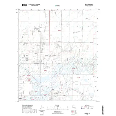
2018 Map of Moss Bluff
USGS Topo · Published 2018About this map
The Calcasieu River system dominates this portion of Calcasieu Parish, where the northern reaches of Lake Charles meet the expanding communities of Moss Bluff and Westlake. This 2018 survey documents a landscape defined by intricate waterways, featuring numerous bays such as Alligator Bay, Burnett Bay, and Old Town Bay. The map provides significant genealogical value through its marking of local burial grounds, including Ritchie Cem, Goos Cem, and the Birdsnest Cem near Belfield. Commercial and transport hubs like the Chloe Airport and the industrial interface at Bridge Junction are clearly visible, illustrating the transition from the dense residential developments in Newton to the low-lying wetlands of Bear Island and Two O'Clock Point. The presence of the Goldsmith Canal and various gullies underscores the complex water management required in this coastal prairie and bayou region.
Find a feature on this map
200 named features on this map. Tap any name to fly to it.
Don’t see what you’re looking for? This feature index may not catch every label — zoom into the map to look around manually.
Map Details
Editions of this 2018 Moss Bluff Map
This is the sole edition of this map. No revisions or reprints were ever made.
Other maps of this area

1932 · Lake Charles NE
USGS Topo · 1:31,680

1932 · Lake Charles NW
USGS Topo · 1:31,680

1935 · Buhler
USGS Topo · 1:31,680

1935 · Moss Bluff
USGS Topo · 1:31,680

1935 · Gordon
USGS Topo · 1:31,680

1935 · Gaytine
USGS Topo · 1:31,680

1942 · Lake Charles
USGS Topo · 1:62,500

1947 · Gaytine
USGS Topo · 1:31,680

1947 · Moss Bluff
USGS Topo · 1:31,680

1947 · Hecker
USGS Topo · 1:31,680