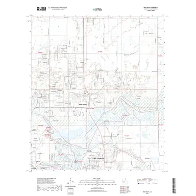
2020 Map of Moss Bluff
USGS Topo · Published 2020About this map
Moss Bluff and the surrounding Calcasieu Parish landscape are defined by the intricate confluence of the Calcasieu River and the West Fork Calcasieu River. In this modern 2020 record, the northern reaches of Lake Charles extend toward Goosport, where the Kansas City Southern Ry cuts through a region thick with historical family and community markers. The map reveals a high density of local burial sites, including Birdsnest Cem, Bagdad Cem, and the Old Emanuel Church Cem, which serve as vital touchstones for genealogists studying the families of Ararat and Belfield. East of the river, a complex network of bays such as Burnett Bay, Goss Bay, and Aligator Bay illustrates the hydrologic character of the Louisiana coast, while the presence of the Chloe Airport and numerous residential developments shows the continued growth of the area near Newton and Goss.
Find a feature on this map
208 named features on this map. Tap any name to fly to it.
Don’t see what you’re looking for? This feature index may not catch every label — zoom into the map to look around manually.
Map Details
Editions of this 2020 Moss Bluff Map
This is the sole edition of this map. No revisions or reprints were ever made.
Other maps of this area

1932 · Lake Charles NE
USGS Topo · 1:31,680

1932 · Lake Charles NW
USGS Topo · 1:31,680

1935 · Buhler
USGS Topo · 1:31,680

1935 · Moss Bluff
USGS Topo · 1:31,680

1935 · Gordon
USGS Topo · 1:31,680

1935 · Gaytine
USGS Topo · 1:31,680

1942 · Lake Charles
USGS Topo · 1:62,500

1947 · Gaytine
USGS Topo · 1:31,680

1947 · Moss Bluff
USGS Topo · 1:31,680

1947 · Hecker
USGS Topo · 1:31,680