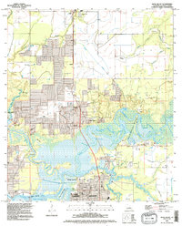
1994 Map of Moss Bluff
USGS Topo · Published 1996About this map
The confluence of the Calcasieu River and English Bayou forms a complex network of wetlands and waterways just north of Lake Charles. This mid-1990s revision reveals the suburban expansion of Moss Bluff and Goosport, where residential development intermingles with an active Oil Field and riparian landscapes. The map preserves several burial grounds, including Birdsnest Cem and Bagdad Cem, providing critical landmarks for genealogists tracking Calcasieu Parish family roots.
Find a feature on this map
53 named features on this map. Tap any name to fly to it.
Don’t see what you’re looking for? This feature index may not catch every label — zoom into the map to look around manually.
Map Details
Editions of this 1994 Moss Bluff Map
This is the sole edition of this map. No revisions or reprints were ever made.
Other maps of this area

1932 · Lake Charles NE
USGS Topo · 1:31,680

1932 · Lake Charles NW
USGS Topo · 1:31,680

1935 · Buhler
USGS Topo · 1:31,680

1935 · Moss Bluff
USGS Topo · 1:31,680

1935 · Gordon
USGS Topo · 1:31,680

1935 · Gaytine
USGS Topo · 1:31,680

1942 · Lake Charles
USGS Topo · 1:62,500

1947 · Gaytine
USGS Topo · 1:31,680

1947 · Moss Bluff
USGS Topo · 1:31,680

1947 · Hecker
USGS Topo · 1:31,680