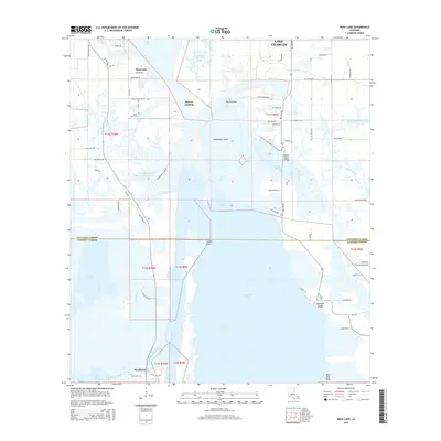
2015 Map of Moss Lake
USGS Topo · Published 2015About this map
Calcasieu Lake dominates this coastal landscape south of Lake Charles, where the intricate waterways of the Calcasieu Ship Channel and the Choupique Cutoff Intracoastal Waterway define the local economy and geography. The map reveals a transition between the northern industrial areas of Burton Landing and the rural marshland to the south. Local heritage is preserved in several small burial grounds including Dutch Cove Cem, Benoit Cem, and Pujol Cem. This 2015 data captures the region's complex water management system, from the Old Canal to the Black Bayou Bridge, highlighting the navigation routes essential to Calcasieu Parish and Cameron Parish. Settlement patterns are concentrated along arterial roads like Big Lake Rd and in the communities of Moss Lake and Hackberry.
Find a feature on this map
73 named features on this map. Tap any name to fly to it.
Don’t see what you’re looking for? This feature index may not catch every label — zoom into the map to look around manually.
Map Details
Editions of this 2015 Moss Lake Map
This is the sole edition of this map. No revisions or reprints were ever made.
Other maps of this area

1932 · Moss Lake
USGS Topo · 1:31,680

1932 · Lake Charles NW
USGS Topo · 1:31,680

1932 · Lake Charles SW
USGS Topo · 1:31,680

1934 · Sweet Lake
USGS Topo · 1:24,000

1934 · Browns Lake
USGS Topo · 1:24,000

1935 · Sweet Lake
USGS Topo · 1:31,680

1935 · Hackberry
USGS Topo · 1:31,680

1935 · Browns Lake
USGS Topo · 1:31,680

1942 · Lake Charles
USGS Topo · 1:62,500

1946 · Moss Lake
USGS Topo · 1:31,680