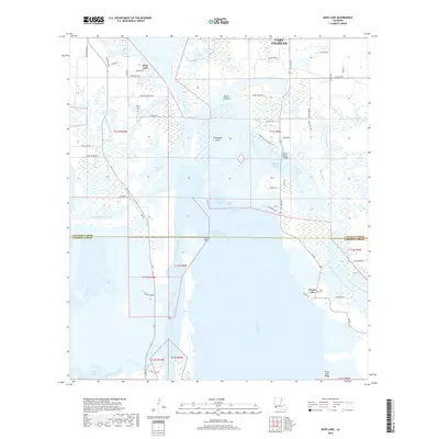
2018 Map of Moss Lake
USGS Topo · Published 2018About this map
Moss Lake and the complex waterways of the Calcasieu River dominate this coastal Louisiana landscape south of Lake Charles. The map documents a highly engineered maritime environment where the massive Calcasieu Ship Channel and the Intracoastal Waterway intersect, facilitating industrial transport through the wetlands. This network of man-made cuts and natural bayous, including the Choupique Cutoff and Old Canal, surrounds Choupique Island and defines the boundary between Calcasieu and Cameron Parishes.
Find a feature on this map
67 named features on this map. Tap any name to fly to it.
Don’t see what you’re looking for? This feature index may not catch every label — zoom into the map to look around manually.
Map Details
Editions of this 2018 Moss Lake Map
This is the sole edition of this map. No revisions or reprints were ever made.
Other maps of this area

1932 · Moss Lake
USGS Topo · 1:31,680

1932 · Lake Charles NW
USGS Topo · 1:31,680

1932 · Lake Charles SW
USGS Topo · 1:31,680

1934 · Sweet Lake
USGS Topo · 1:24,000

1934 · Browns Lake
USGS Topo · 1:24,000

1935 · Sweet Lake
USGS Topo · 1:31,680

1935 · Hackberry
USGS Topo · 1:31,680

1935 · Browns Lake
USGS Topo · 1:31,680

1942 · Lake Charles
USGS Topo · 1:62,500

1946 · Moss Lake
USGS Topo · 1:31,680