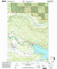
1998 Map of Mossyrock
USGS Topo · Published 2003About this map
Mossyrock and the nearby settlement of Ajlune anchor this landscape, situated at the critical junction where the Cowlitz River was harnessed for hydroelectric power. The map illustrates the massive scale of the Riffe Lake and Mayfield Lake reservoirs, separated by the Mossyrock Dam Spillway. This engineering feat fundamentally altered the local geography, flooding the valley floor while leaving small upland communities like Harmony and Bremer along the Tilton River.
Find a feature on this map
32 named features on this map. Tap any name to fly to it.
Don’t see what you’re looking for? This feature index may not catch every label — zoom into the map to look around manually.
Map Details
Editions of this 1998 Mossyrock Map
This is the sole edition of this map. No revisions or reprints were ever made.
Other maps of this area

1916 · Chehalis
USGS Topo · 1:125,000

1919 · Mount St Helens
USGS Topo · 1:125,000

1937 · Eatonville
USGS Topo · 1:125,000

1942 · Toutle
USGS Topo · 1:62,500

1943 · Willapa
USGS Topo · 1:62,500

1953 · Hoquiam
USGS Topo · 1:250,000

1953 · Toutle
USGS Topo · 1:62,500

1953 · Elk Rock
USGS Topo · 1:62,500

1954 · Onalaska
USGS Topo · 1:62,500

1957 · Hoquiam
USGS Topo · 1:250,000