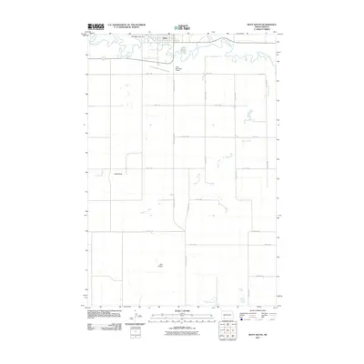
2011 Map of Mott South
USGS Topo · Published 2011About this map
The Cannonball River meanders across the northern portion of this landscape, just downstream of the Mott Watershed Dam. The city of Mott sits at the northern edge of the quadrangle, serving as a hub for the surrounding agricultural community. South of the town center, the Mott Municipal Airport provides a point of connection for this prairie region. The terrain is characterized by a network of drainage ways and high points that served as landmarks for generations of travelers and residents.
Find a feature on this map
22 named features on this map. Tap any name to fly to it.
Don’t see what you’re looking for? This feature index may not catch every label — zoom into the map to look around manually.
Map Details
Editions of this 2011 Mott South Map
This is the sole edition of this map. No revisions or reprints were ever made.
Other maps of this area

1953 · Dickinson
USGS Topo · 1:250,000

1957 · Dickinson
USGS Topo · 1:250,000

1966 · Mott South
USGS Topo · 1:24,000

1966 · Mott NW
USGS Topo · 1:24,000

1966 · Mott SW
USGS Topo · 1:24,000

1966 · Mott North
USGS Topo · 1:24,000

1969 · Burt
USGS Topo · 1:24,000
1969 · Burt NW
USGS Topo · 1:24,000

1974 · Pearl Butte NW
USGS Topo · 1:24,000

1974 · Long Butte
USGS Topo · 1:24,000