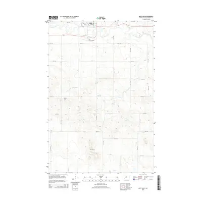
2014 Map of Mott South
USGS Topo · Published 2014About this map
Mott sits at the northern edge of this high plains landscape, situated along the winding course of the Cannonball River. The terrain south of the settlement is defined by a grid of agricultural section lines and significant geological landmarks that rise above the prairie. Castle Rock and Gert Buttes stand as prominent topographical features in an area otherwise marked by the subtle drainage patterns of Mehrer Cr and Timber Cr.
Find a feature on this map
34 named features on this map. Tap any name to fly to it.
Don’t see what you’re looking for? This feature index may not catch every label — zoom into the map to look around manually.
Map Details
Editions of this 2014 Mott South Map
This is the sole edition of this map. No revisions or reprints were ever made.
Other maps of this area

1953 · Dickinson
USGS Topo · 1:250,000

1957 · Dickinson
USGS Topo · 1:250,000

1966 · Mott South
USGS Topo · 1:24,000

1966 · Mott NW
USGS Topo · 1:24,000

1966 · Mott SW
USGS Topo · 1:24,000

1966 · Mott North
USGS Topo · 1:24,000

1969 · Burt
USGS Topo · 1:24,000
1969 · Burt NW
USGS Topo · 1:24,000

1974 · Pearl Butte NW
USGS Topo · 1:24,000

1974 · Long Butte
USGS Topo · 1:24,000