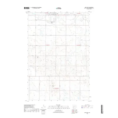
2018 Map of Mott South
USGS Topo · Published 2018About this map
The Cannonball River winds through the northern edge of this landscape, anchoring the settlement of Mott as it appeared in the late 2010s. This agricultural region in Hettinger County is defined by a grid of rural sections and local roads, such as 73rd St SW and 78th St SW, which facilitate movement between the town center and outlying farmstead sites. Just south of the municipal core, the Mott Municipal Airport serves as a vital transportation link for this portion of the Great Plains.
Find a feature on this map
23 named features on this map. Tap any name to fly to it.
Don’t see what you’re looking for? This feature index may not catch every label — zoom into the map to look around manually.
Map Details
Editions of this 2018 Mott South Map
This is the sole edition of this map. No revisions or reprints were ever made.
Other maps of this area

1953 · Dickinson
USGS Topo · 1:250,000

1957 · Dickinson
USGS Topo · 1:250,000

1966 · Mott South
USGS Topo · 1:24,000

1966 · Mott NW
USGS Topo · 1:24,000

1966 · Mott SW
USGS Topo · 1:24,000

1966 · Mott North
USGS Topo · 1:24,000

1969 · Burt
USGS Topo · 1:24,000
1969 · Burt NW
USGS Topo · 1:24,000

1974 · Pearl Butte NW
USGS Topo · 1:24,000

1974 · Long Butte
USGS Topo · 1:24,000