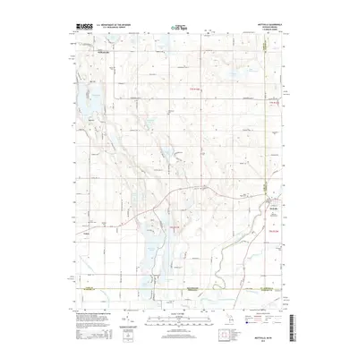
2014 Map of Mottville
USGS Topo · Published 2014About this map
Mottville and the Saint Joseph River corridor anchor this geographic study of the borderlands where Michigan meets Indiana. The landscape is defined by glacial kettle lakes and drainages, including the Pigeon River and Trout Creek, which create a complex network of waterways across Mottville Township. This area preserves numerous family and community burial sites such as White Pigeon Cem, Shavehead Cem, and Merritt Cem, offering significant value for genealogical research in Saint Joseph and Cass Counties.
Find a feature on this map
123 named features on this map. Tap any name to fly to it.
Don’t see what you’re looking for? This feature index may not catch every label — zoom into the map to look around manually.
Map Details
Editions of this 2014 Mottville Map
This is the sole edition of this map. No revisions or reprints were ever made.
Other maps of this area

1914 · Three Rivers
USGS Topo · 1:62,500

1916 · Three Rivers
USGS Topo · 1:62,500

1943 · Three Rivers
USGS Topo · 1:62,500

1948 · Vandalia
USGS Topo · 1:62,500

1949 · Vandalia
USGS Topo · 1:62,500

1953 · Fort Wayne
USGS Topo · 1:250,000

1956 · Fort Wayne
USGS Topo · 1:250,000
1961 · Bristol
USGS Topo · 1:24,000
1961 · Middlebury
USGS Topo · 1:24,000
1961 · Elkhart
USGS Topo · 1:24,000