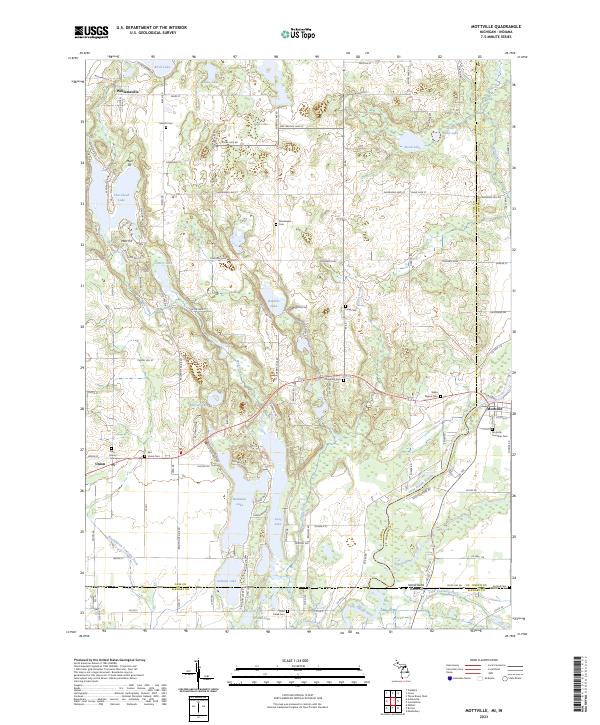
2023 Map of Mottville
USGS Topo · Published 2023About this map
Mottville and the Saint Joseph River anchor this Michigan-Indiana borderland, where historical township cemeteries and scattered small lakes define the landscape. The river flows through the southeastern portion of the sheet, joined by the Pigeon River and Trout Creek near the state line. Settlement is concentrated in the small communities of Williamsville, Union, and Mottville, each with its own local burial grounds such as East Union Cem and the Mottville Township Cem. A legacy of local industry appears at the Marl Pit near Shavehead Lake, indicating early extraction of lime-rich mud for agriculture or cement. The map reveals a complex water system including Baldwins Lake, Bellows Lake, and several drainage projects like the Washington Township Ditch, illustrating how the region's natural hydrology was managed to support both local residents and the surrounding farmland.
Find a feature on this map
109 named features on this map. Tap any name to fly to it.
Don’t see what you’re looking for? This feature index may not catch every label — zoom into the map to look around manually.
Map Details
Editions of this 2023 Mottville Map
This is the sole edition of this map. No revisions or reprints were ever made.
Other maps of this area

1914 · Three Rivers
USGS Topo · 1:62,500

1916 · Three Rivers
USGS Topo · 1:62,500

1943 · Three Rivers
USGS Topo · 1:62,500

1948 · Vandalia
USGS Topo · 1:62,500

1949 · Vandalia
USGS Topo · 1:62,500

1953 · Fort Wayne
USGS Topo · 1:250,000

1956 · Fort Wayne
USGS Topo · 1:250,000
1961 · Bristol
USGS Topo · 1:24,000
1961 · Middlebury
USGS Topo · 1:24,000
1961 · Elkhart
USGS Topo · 1:24,000