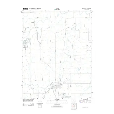
2012 Map of Mound City
USGS Topo · Published 2012About this map
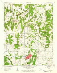
Big Sugar Creek and Little Sugar Creek wind through this section of Linn County, shaping the landscape near the community of Farlinville. The map reveals a rural structure defined by established family and community landmarks, including several burial grounds such as Linnville Cemetery, Fairbanks Cemetery, and Mount Carmel Cemetery. The grid of county roads, including Massey Road and Orahood Road, connects these disparate points of interest across the prairie. Residential developments appear clustered around small water bodies like Timber Lake and Lake De Lago, contrasting with the more open agricultural reaches to the south. Near the southern edge of the quadrangle, the local center includes a Post Office and Park Cemetery, while Gilmore Airport sits at the far southeastern corner, highlighting the area's modern infrastructure within a deeply rooted rural context.
Find a feature on this map
85 named features on this map. Tap any name to fly to it.
Don’t see what you’re looking for? This feature index may not catch every label — zoom into the map to look around manually.
Map Details
Editions of this 2012 Mound City Map
This is the sole edition of this map. No revisions or reprints were ever made.
Other maps of this area

1887 · Mound City
USGS Topo · 1:125,000

1893 · Mound City
USGS Topo · 1:125,000

1947 · Lawrence
USGS Topo · 1:250,000

1950 · Lawrence
USGS Topo · 1:250,000

1956 · Lawrence
USGS Topo · 1:250,000
1957 · Boicourt
USGS Topo · 1:24,000

1958 · La Cygne
USGS Topo · 1:24,000
1958 · Pleasanton
USGS Topo · 1:24,000
1958 · Prescott
USGS Topo · 1:24,000
1958 · Mound City
USGS Topo · 1:24,000