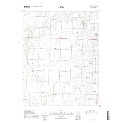
2017 Map of Moundville
USGS Topo · Published 2017About this map
Moundville and the small settlement of Ellis anchor this Vernon County landscape, where the Marmaton River meanders through the northern plains. The terrain is defined by its water features, ranging from natural oxbows and sloughs like Big Lake and Ben's Slough to man-made impoundments such as the Richard McWherter Reservoir. The Western Missouri prairie here is deeply integrated with rural life, as evidenced by the high density of small family or community burial grounds, including Miller Cem, Hackberry Cem, and Welborn Cem. To the northeast, the outskirts of Nevada begin to appear, transitioning from the open agricultural fields that characterize the rest of the sheet. The drainage patterns of Dry Wood Creek and Ingram Cr reveal the low-lying nature of the region, where numerous small lakes like Lively Lake and O'Connell Lake dot the landscape between section-line roads.
Find a feature on this map
67 named features on this map. Tap any name to fly to it.
Don’t see what you’re looking for? This feature index may not catch every label — zoom into the map to look around manually.
Map Details
Editions of this 2017 Moundville Map
This is the sole edition of this map. No revisions or reprints were ever made.
Other maps of this area

1884 · Fort Scott
USGS Topo · 1:125,000

1886 · Nevada
USGS Topo · 1:125,000

1886 · Fort Scott
USGS Topo · 1:125,000

1893 · Fort Scott
USGS Topo · 1:125,000

1894 · Nevada
USGS Topo · 1:125,000

1933 · Camp Clark
USGS Topo · 1:24,000

1938 · Metz
USGS Topo · 1:24,000

1938 · Horton
USGS Topo · 1:24,000

1939 · Metz
USGS Topo · 1:24,000

1939 · Horton
USGS Topo · 1:24,000