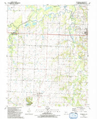
1991 Map of Moundville
USGS Topo · Published 1991About this map
The Marmaton River snakes across the northern reaches of this Vernon County landscape, defining a low-lying basin of sloughs and oxbow lakes like Stultz Lake and Lively Lake. By the early 1990s, much of the western terrain was dedicated to conservation, notably the Big Drywood Creek State Wildlife Areas and the Flight Lake Natural Area. The settlement pattern centers on the village of Moundville and the smaller community of Ellis, with the western edge of Nevada appearing on the eastern margin.
Find a feature on this map
38 named features on this map. Tap any name to fly to it.
Don’t see what you’re looking for? This feature index may not catch every label — zoom into the map to look around manually.
Map Details
Editions of this 1991 Moundville Map
This is the sole edition of this map. No revisions or reprints were ever made.
Other maps of this area

1884 · Fort Scott
USGS Topo · 1:125,000

1886 · Nevada
USGS Topo · 1:125,000

1886 · Fort Scott
USGS Topo · 1:125,000

1893 · Fort Scott
USGS Topo · 1:125,000

1894 · Nevada
USGS Topo · 1:125,000

1933 · Camp Clark
USGS Topo · 1:24,000

1938 · Metz
USGS Topo · 1:24,000

1938 · Horton
USGS Topo · 1:24,000

1939 · Metz
USGS Topo · 1:24,000

1939 · Horton
USGS Topo · 1:24,000