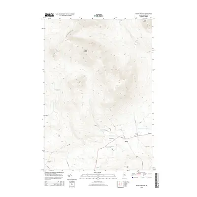
2014 Map of Mount Abraham
USGS Topo · Published 2014About this map
Mount Abraham dominates the high-altitude landscape of northern Franklin County, where the Appalachian National Scenic Trail winds across the high ridges of Lone Mountain and down toward Perham Stream. The settlement patterns here are defined by the sharp transition from these steep peaks to the river valleys below. To the southeast, the village of Salem sits near the confluence of the W Br Carrabassett River and Quick Stream, serving as a focal point for local travel along Salem Rd and Kirts Corner Rd. Genealogists and local historians can locate the Mt Abram Cem situated just north of the village. The northern half of the sheet remains largely primitive, marked by significant elevations like Black Nubble and Farmer Mountain, while the southern reaches show a network of rural routes such as Old Bray Hill Rd and Webber Rd that connect isolated landmarks like Bray Hill and Tory Hill.
Find a feature on this map
36 named features on this map. Tap any name to fly to it.
Don’t see what you’re looking for? This feature index may not catch every label — zoom into the map to look around manually.
Map Details
Editions of this 2014 Mount Abraham Map
This is the sole edition of this map. No revisions or reprints were ever made.
Other maps of this area

1928 · Dead River
USGS Topo · 1:62,500

1928 · Stratton
USGS Topo · 1:48,000

1929 · Phillips
USGS Topo · 1:48,000

1930 · Kingfield
USGS Topo · 1:48,000

1931 · Dead River
USGS Topo · 1:48,000

1932 · Phillips
USGS Topo · 1:62,500

1932 · Stratton
USGS Topo · 1:62,500

1932 · Kingfield
USGS Topo · 1:62,500

1944 · Dead River
USGS Topo · 1:62,500

1949 · Jackman
USGS Topo · 1:250,000