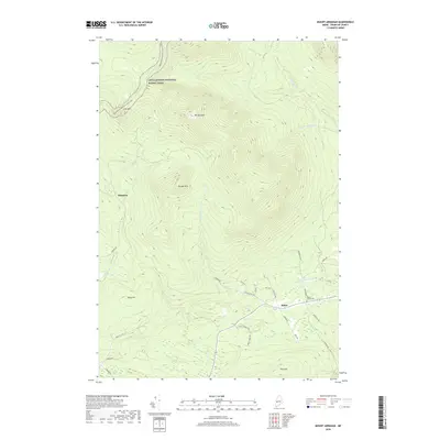
2018 Map of Mount Abraham
USGS Topo · Published 2018About this map
Mt Abraham dominates the central landscape of this Franklin County quadrangle, where the Appalachian National Scenic Trail winds across high ridges including Lone Mtn. To the south, the settlement of Salem is situated near the W Br Carrabassett River, serving as a hub for local routes like Fish Hatchery Rd and Bray Hill Rd. This area reflects a traditional Maine mountain economy and landscape, characterized by isolated settlements like Barnjum and significant topographical landmarks such as Farmer Mtn and Tory Hill. Genealogists and local historians can locate the Mount Abram Cem east of Salem, while the drainage patterns of Rapid Stream, Norton Brook, and Perham Stream illustrate the complex watershed that defines the region's geography.
Find a feature on this map
34 named features on this map. Tap any name to fly to it.
Don’t see what you’re looking for? This feature index may not catch every label — zoom into the map to look around manually.
Map Details
Editions of this 2018 Mount Abraham Map
This is the sole edition of this map. No revisions or reprints were ever made.
Other maps of this area

1928 · Dead River
USGS Topo · 1:62,500

1928 · Stratton
USGS Topo · 1:48,000

1929 · Phillips
USGS Topo · 1:48,000

1930 · Kingfield
USGS Topo · 1:48,000

1931 · Dead River
USGS Topo · 1:48,000

1932 · Phillips
USGS Topo · 1:62,500

1932 · Stratton
USGS Topo · 1:62,500

1932 · Kingfield
USGS Topo · 1:62,500

1944 · Dead River
USGS Topo · 1:62,500

1949 · Jackman
USGS Topo · 1:250,000