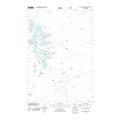
2011 Map of Mount Adams East
USGS Topo · Published 2011About this map
Mount Adams anchors this high-elevation landscape, where a massive system of ice and snow creates a radial drainage pattern across Yakima County. The map documents an extensive glacial network including the Lava Glacier, Lyman Glacier, Wilson Glacier, and the sprawling Klickitat Glacier. To the east of the primary summit, the terrain drops through Roosevelt Cliff and Victory Ridge into the deep incision of Avalanche Valley. This 2011 survey illustrates the high-country recreation infrastructure of the era, from the Timberline Campground and Cold Springs Campground at the edge of the timberline to the Bird Creek Meadows Picnic Area. Between the peaks of The Castle and The Spearhead, the map captures the complex alpine hydrology of the Muddy Fork and Big Muddy Creek, providing an essential record of the mountain's cryosphere and seasonal runoff patterns.
Find a feature on this map
54 named features on this map. Tap any name to fly to it.
Don’t see what you’re looking for? This feature index may not catch every label — zoom into the map to look around manually.
Map Details
Editions of this 2011 Mount Adams East Map
This is the sole edition of this map. No revisions or reprints were ever made.
Other maps of this area

1904 · Mount Adams
USGS Topo · 1:125,000

1907 · Mount Adams
USGS Topo · 1:125,000

1926 · Steamboat Mtn
USGS Topo · 1:125,000

1931 · Steamboat Mtn
USGS Topo · 1:125,000

1950 · Yakima
USGS Topo · 1:250,000

1958 · Yakima
USGS Topo · 1:250,000

1961 · Yakima
USGS Topo · 1:250,000
1970 · Glenwood
USGS Topo · 1:24,000
1970 · Trout Lake
USGS Topo · 1:24,000
1970 · Mount Adams West
USGS Topo · 1:24,000