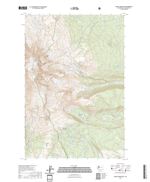
2023 Map of Mount Adams East
USGS Topo · Published 2023About this map
The glacial and volcanic mass of Mt Adams dominates the landscape of Yakima County, showing a complex network of active ice and ancient geological formations. High-altitude features like the Adams Glacier, Klickitat Glacier, and Mazama Glacier radiate from the summit, feeding the headwaters of the Muddy Fork and Big Muddy Creek. The eastern slopes transition from permanent ice into dramatic landforms like the Ridge of Wonders and the massive A G Aiken Lava Bed to the south.
Find a feature on this map
65 named features on this map. Tap any name to fly to it.
Don’t see what you’re looking for? This feature index may not catch every label — zoom into the map to look around manually.
Map Details
Editions of this 2023 Mount Adams East Map
This is the sole edition of this map. No revisions or reprints were ever made.
Other maps of this area

1904 · Mount Adams
USGS Topo · 1:125,000

1907 · Mount Adams
USGS Topo · 1:125,000

1926 · Steamboat Mtn
USGS Topo · 1:125,000

1931 · Steamboat Mtn
USGS Topo · 1:125,000

1950 · Yakima
USGS Topo · 1:250,000

1958 · Yakima
USGS Topo · 1:250,000

1961 · Yakima
USGS Topo · 1:250,000
1970 · Glenwood
USGS Topo · 1:24,000
1970 · Trout Lake
USGS Topo · 1:24,000
1970 · Mount Adams West
USGS Topo · 1:24,000