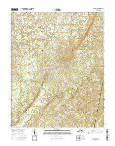
2016 Map of Mount Airy
USGS Topo · Published 2016About this map
Mount Airy serves as a central point in this rural landscape within Pittsylvania County, characterized by the winding paths of the Banister River and the provocatively named Stinking River. The map documents a predominantly agrarian region where small settlements like Renan, Riceville, and Markham are connected by a network of local roads such as Johnson Mill Rd and Deer Track Farm Rd. These corridors follow the natural topography, tracing the ridges between numerous watercourses including Bird Cr, Flyblow Cr, and Straightstone Cr. Along the eastern boundary, the map delineates the border between Pittsylvania Co and Halifax Co, highlighting the geographic divide as the land slopes toward Hermosa. The distribution of these named creeks and family-road identifiers provides a detailed look at the rural infrastructure of Southside Virginia in the early 21st century.
Find a feature on this map
63 named features on this map. Tap any name to fly to it.
Don’t see what you’re looking for? This feature index may not catch every label — zoom into the map to look around manually.
Map Details
Editions of this 2016 Mount Airy Map
This is the sole edition of this map. No revisions or reprints were ever made.
Other maps of this area

1892 · Lynchburg
USGS Topo · 1:125,000

1921 · Chatham
USGS Topo · 1:48,000

1923 · Chatham
USGS Topo · 1:62,500

1947 · Roanoke
USGS Topo · 1:250,000

1951 · Altavista
USGS Topo · 1:62,500

1953 · Greensboro
USGS Topo · 1:250,000

1954 · Greensboro
USGS Topo · 1:250,000

1954 · Riceville
USGS Topo · 1:62,500

1956 · Gladys
USGS Topo · 1:62,500

1959 · Roanoke
USGS Topo · 1:250,000