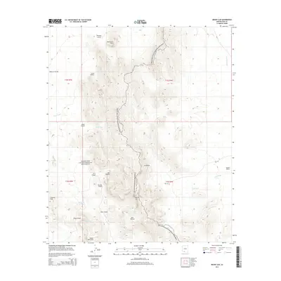
2014 Map of Mount Ajo
USGS Topo · Published 2014About this map
Organ Pipe Cactus National Monument dominates this desert landscape, defined by the stark rise of the Ajo Range and the high summit of Mount Ajo. This 2014 survey captures a terrain shaped by deep canyons and intermittent water sources essential to the local environment, such as Bull Pasture Spring and Wild Horse Tank. The geography is characterized by distinct geological landmarks like the Montezuma Head and the Ajo Window, highlighting the complex topography of the Diablo Mountains and the surrounding Valley of the Ajo. Settlement and infrastructure are minimal, represented primarily by the primitive Well Rd passing through Tonoka Valley. Drainage patterns are clearly marked by several large washes, including Pia Oik Wash and Gu Vo Wash, which channel seasonal runoff through this arid region of the Gu Vo District.
Find a feature on this map
29 named features on this map. Tap any name to fly to it.
Don’t see what you’re looking for? This feature index may not catch every label — zoom into the map to look around manually.
Map Details
Editions of this 2014 Mount Ajo Map
This is the sole edition of this map. No revisions or reprints were ever made.
Other maps of this area

1953 · Ajo
USGS Topo · 1:250,000

1954 · Sonoyta
USGS Topo · 1:250,000

1957 · Ajo
USGS Topo · 1:250,000

1958 · Ajo
USGS Topo · 1:250,000

1962 · Ajo
USGS Topo · 1:250,000

1963 · Ajo
USGS Topo · 1:250,000

1963 · Mt. Ajo
USGS Topo · 1:62,500

1963 · Lukeville
USGS Topo · 1:62,500

1963 · Kino Peak
USGS Topo · 1:62,500

1963 · Lukeville
USGS Topo · 1:250,000