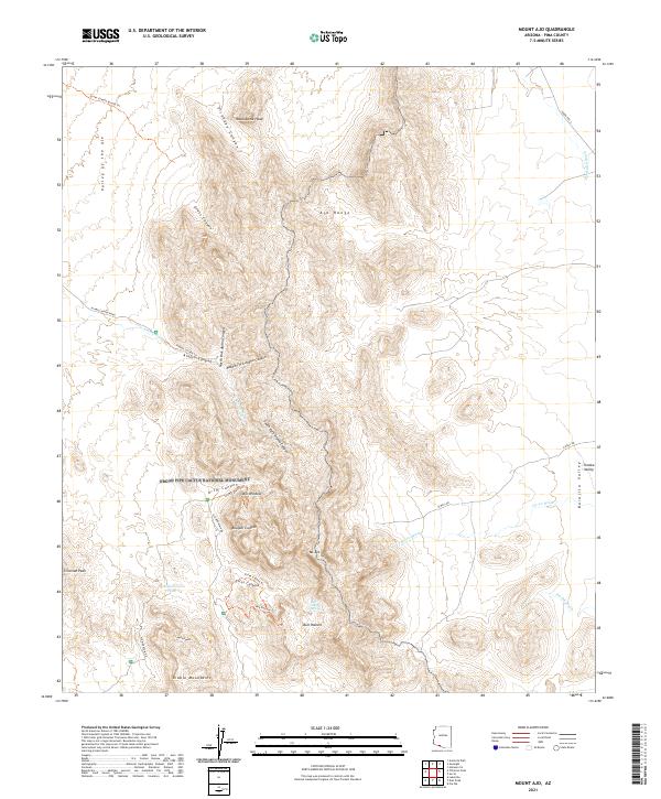
2021 Map of Mount Ajo
USGS Topo · Published 2021About this map
The Ajo Range and the Diablo Mountains dominate this protected landscape within the Organ Pipe Cactus National Monument. This high-desert environment is defined by dramatic vertical relief, stretching from the floor of the Valley of the Ajo and Barajita Valley to prominent heights like Mt Ajo, Montezuma Head, and Tillotson Peak. The map reveals a network of primitive transportation and water sources essential to the area's geography, including Ajo Mountain Dr and various trail systems like the Bull Pasture Trl and Alamo Canyon Trl. Seasonal drainage patterns are marked by numerous washes such as Alamo Wash and Gu Vo Wash, while rare water points like Wild Horse Tank and Bull Pasture Spring indicate the critical locations where moisture persists in this arid terrain. Notable landmarks like the Arch Window in Arch Canyon highlight the geological character of the region.
Find a feature on this map
39 named features on this map. Tap any name to fly to it.
Don’t see what you’re looking for? This feature index may not catch every label — zoom into the map to look around manually.
Map Details
Editions of this 2021 Mount Ajo Map
This is the sole edition of this map. No revisions or reprints were ever made.
Other maps of this area

1953 · Ajo
USGS Topo · 1:250,000

1954 · Sonoyta
USGS Topo · 1:250,000

1957 · Ajo
USGS Topo · 1:250,000

1958 · Ajo
USGS Topo · 1:250,000

1962 · Ajo
USGS Topo · 1:250,000

1963 · Ajo
USGS Topo · 1:250,000

1963 · Mt. Ajo
USGS Topo · 1:62,500

1963 · Lukeville
USGS Topo · 1:62,500

1963 · Kino Peak
USGS Topo · 1:62,500

1963 · Lukeville
USGS Topo · 1:250,000