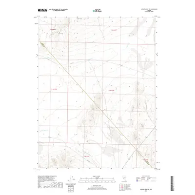
2018 Map of Mount Annie SE
USGS Topo · Published 2018About this map
Gabbs Valley defines this arid landscape along the border of Nye and Mineral counties. The terrain is characterized by the expansive Gabbs Wash and Finger Rock Wash, which drain the surrounding highlands toward the valley floor. To the north, the Cobble Cuesta stands as a distinct topographical feature. This 2018 survey reveals a sparsely developed region where human presence is primarily marked by rural corridors like Rawhide Rd and the utilitarian H 2 Bar Rd. The mapping of these ephemeral watercourses and section lines provides a clear view of the complex township and range system that governs the public lands in this part of the Great Basin.
Find a feature on this map
13 named features on this map. Tap any name to fly to it.
Don’t see what you’re looking for? This feature index may not catch every label — zoom into the map to look around manually.
Map Details
Editions of this 2018 Mount Annie SE Map
This is the sole edition of this map. No revisions or reprints were ever made.
Other maps of this area

1907 · Tonopah
USGS Topo · 1:250,000

1908 · Tonopah
USGS Topo · 1:250,000

1909 · Hawthorne
USGS Topo · 1:250,000

1911 · Hawthorne
USGS Topo · 1:250,000

1915 · Hawthorne
USGS Topo · 1:250,000

1948 · Paradise Peak
USGS Topo · 1:62,500

1948 · Walker Lake
USGS Topo · 1:250,000

1950 · Paradise Peak
USGS Topo · 1:62,500

1956 · Tonopah
USGS Topo · 1:250,000

1957 · Walker Lake
USGS Topo · 1:250,000