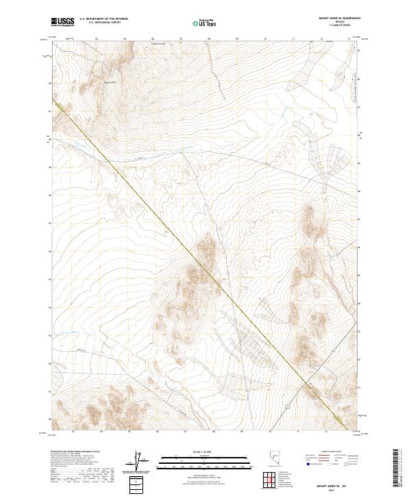
2021 Map of Mount Annie SE
USGS Topo · Published 2021About this map
Gabbs Valley defines this arid landscape in central Nevada, where the drainage systems of Gabbs Wash and Finger Rock Wash cut through the high desert. The area is marked by a significant administrative boundary where the Nye Co Mineral Co line bisects the terrain. Remote access is provided by unpaved tracks like H 2 Bar Rd and Rawhide Rd, which navigate the elevation changes near Cobble Cuesta. This topographical study by the U.S. Geological Survey captures a sparsely populated region primarily characterized by its hydrographic patterns and township subdivisions, including t12n r34e and t11n r35e, reflecting the structured management of public lands in the Great Basin.
Find a feature on this map
13 named features on this map. Tap any name to fly to it.
Don’t see what you’re looking for? This feature index may not catch every label — zoom into the map to look around manually.
Map Details
Editions of this 2021 Mount Annie SE Map
This is the sole edition of this map. No revisions or reprints were ever made.
Other maps of this area

1907 · Tonopah
USGS Topo · 1:250,000

1908 · Tonopah
USGS Topo · 1:250,000

1909 · Hawthorne
USGS Topo · 1:250,000

1911 · Hawthorne
USGS Topo · 1:250,000

1915 · Hawthorne
USGS Topo · 1:250,000

1948 · Paradise Peak
USGS Topo · 1:62,500

1948 · Walker Lake
USGS Topo · 1:250,000

1950 · Paradise Peak
USGS Topo · 1:62,500

1956 · Tonopah
USGS Topo · 1:250,000

1957 · Walker Lake
USGS Topo · 1:250,000