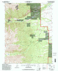
1994 Map of Mount Antero
USGS Topo · Published 1998About this map
Mount Princeton Hot Springs serves as a prominent landmark in this high-altitude corner of the San Isabel National Forest, where the transition from riparian valleys to soaring peaks is sharply defined. The landscape is dominated by massive summits, including Mount Antero, Mount White, and Tabeguache Peak, while the distinctive Chalk Cliffs rise above the drainage of Chalk Creek. This 1994 revision captures a geography shaped by both recreation and resource extraction, evidenced by the Colorado Trail winding through the terrain alongside numerous mining sites like the Lucky Mine and various Prospects. Human management of the environment is further visible in the Chalk Cliff Fish Hatchery and the Bowen Ditch, reflecting the importance of water control in this alpine environment. The presence of a Landing Strip and Communication Towers indicates the modernization of this once-remote mining and resort district.
Find a feature on this map
41 named features on this map. Tap any name to fly to it.
Don’t see what you’re looking for? This feature index may not catch every label — zoom into the map to look around manually.
Map Details
Editions of this 1994 Mount Antero Map
This is the sole edition of this map. No revisions or reprints were ever made.
Other maps of this area

1940 · Garfield
USGS Topo · 1:62,500

1945 · Garfield
USGS Topo · 1:62,500

1955 · Buena Vista
USGS Topo · 1:62,500

1955 · Mount Harvard
USGS Topo · 1:62,500

1956 · Poncha Springs
USGS Topo · 1:62,500

1956 · Montrose
USGS Topo · 1:250,000

1959 · Montrose
USGS Topo · 1:250,000

1960 · Montrose
USGS Topo · 1:250,000

1968 · Montrose
USGS Topo · 1:250,000

1982 · Buena Vista West
USGS Topo · 1:24,000