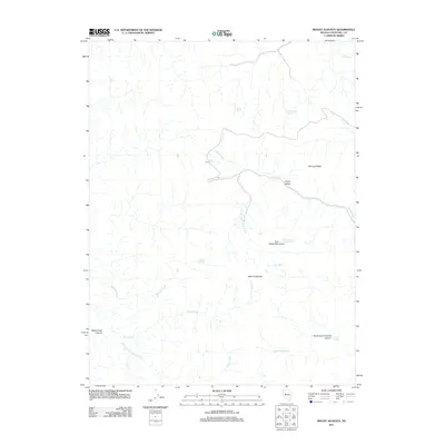
2011 Map of Mount Augusta
USGS Topo · Published 2011About this map
Mount Augusta and the high ridges of the Clan Alpine Mountains dominate this high-desert landscape in Churchill County. This 2011 survey illustrates a region defined by its vital water sources, where numerous named springs such as Cherry Spring Number One, Florence Spring, and Kaiser Spring provide the only reliability in a network of ephemeral drainages. The topography is etched by deep cuts like Horse Creek Canyon and the North Fork Florence Canyon, while Railroad Ridge stands as a prominent terrestrial landmark above the drainage of Cherry Creek. The presence of Cherry Valley suggests a pocket of relatively level terrain amidst the surrounding slopes. The map traces the natural water courses of Sagehen Creek and Horse Creek, showing how these features dictate the navigation of this interior Nevada range.
Find a feature on this map
21 named features on this map. Tap any name to fly to it.
Don’t see what you’re looking for? This feature index may not catch every label — zoom into the map to look around manually.
Map Details
Editions of this 2011 Mount Augusta Map
This is the sole edition of this map. No revisions or reprints were ever made.
Other maps of this area

1908 · Carson Sink
USGS Topo · 1:250,000

1910 · Carson Sink
USGS Topo · 1:250,000

1955 · Millett
USGS Topo · 1:250,000

1957 · Reno
USGS Topo · 1:250,000

1959 · Reno
USGS Topo · 1:250,000

1959 · Millett
USGS Topo · 1:250,000

1960 · Reno
USGS Topo · 1:250,000

1966 · Clan Alpine Ranch
USGS Topo · 1:62,500

1969 · Camp Creek Canyon
USGS Topo · 1:24,000

1969 · Cold Springs
USGS Topo · 1:24,000