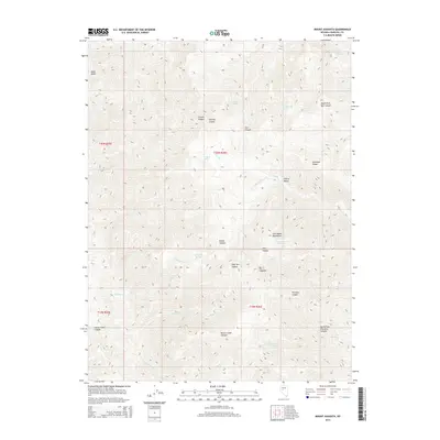
2014 Map of Mount Augusta
USGS Topo · Published 2014About this map
Mt Augusta rises as the central landmark within the Clan Alpine Mountains in this high-desert Nevada landscape. The terrain is defined by a series of steep, radial drainages and ridges, such as Railroad Ridge and Paiute Canyon, which illustrate the complex geomorphology of the Great Basin. Small water sources, critical in this arid environment, are scattered throughout the mountain range, including Starr Spring, Sagehen Spring, and Cherry Spring Number One. These springs often dictate the naming of the surrounding features, as seen with Sage Hen Canyon and Horse Creek Canyon. Along the periphery, distinct geological features like Black Butte and the broad Cherry Valley provide contrast to the high peaks. The township and range boundaries of t20n r36e and surrounding sections mark the public land survey system grid over this largely uninhabited portion of Churchill County.
Find a feature on this map
35 named features on this map. Tap any name to fly to it.
Don’t see what you’re looking for? This feature index may not catch every label — zoom into the map to look around manually.
Map Details
Editions of this 2014 Mount Augusta Map
This is the sole edition of this map. No revisions or reprints were ever made.
Other maps of this area

1908 · Carson Sink
USGS Topo · 1:250,000

1910 · Carson Sink
USGS Topo · 1:250,000

1955 · Millett
USGS Topo · 1:250,000

1957 · Reno
USGS Topo · 1:250,000

1959 · Reno
USGS Topo · 1:250,000

1959 · Millett
USGS Topo · 1:250,000

1960 · Reno
USGS Topo · 1:250,000

1966 · Clan Alpine Ranch
USGS Topo · 1:62,500

1969 · Camp Creek Canyon
USGS Topo · 1:24,000

1969 · Cold Springs
USGS Topo · 1:24,000