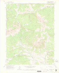
1961 Map of Mount Axtell
USGS Topo · Published 1969About this map
Gunnison National Forest serves as the backdrop for this mapping of a productive mining district in the early 1960s. The landscape is defined by its industrial history, centered on the coal and anthracite deposits near the settlements of Irwin, Baldwin, and the Ruby townsite. Industrial infrastructure is prominent, including the Baldwin Mine, Keystone Mine, and Forest Queen Mine, alongside tailings ponds and a Gaging Station.
Find a feature on this map
42 named features on this map. Tap any name to fly to it.
Don’t see what you’re looking for? This feature index may not catch every label — zoom into the map to look around manually.
Map Details
Editions of this 1961 Mount Axtell Map
4 editions found
Other maps of this area

1888 · Crested Butte
USGS Topo · 1:62,500

1888 · Anthracite
USGS Topo · 1:62,500

1889 · Crested Butte
USGS Topo · 1:62,500

1889 · Anthracite
USGS Topo · 1:62,500

1893 · Anthracite
USGS Topo · 1:62,500

1893 · Crested Butte
USGS Topo · 1:62,500

1894 · Anthracite
USGS Topo · 1:62,500

1956 · Montrose
USGS Topo · 1:250,000

1959 · Montrose
USGS Topo · 1:250,000

1960 · Montrose
USGS Topo · 1:250,000