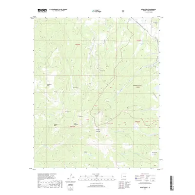
2018 Map of Mount Baldy
USGS Topo · Published 2018About this map
The high alpine country of Apache National Forest dominates this landscape, centered on the towering summits of the White Mountains. Key peaks including Mt Baldy, Baldy Peak, and Mt Thomas form a dramatic hydrologic divide, giving rise to the headwaters of several major regional drainage systems. From these heights, the W Fork Little Colorado River and E Fork Little Colorado River flow toward the north, while the W Fork Black River and E Fork White River originate on the southern slopes. This intricate network of mountain streams is interspersed with high-altitude wetlands or cienegas, such as Bonito Cienega, Hall Cienega, and Smith Cienega. A notable historical imprint on the land is the Railroad Grade in the northeast, marking the path of former industrial or logging transport through these high forests.
Find a feature on this map
57 named features on this map. Tap any name to fly to it.
Don’t see what you’re looking for? This feature index may not catch every label — zoom into the map to look around manually.
Map Details
Editions of this 2018 Mount Baldy Map
This is the sole edition of this map. No revisions or reprints were ever made.
Other maps of this area

1886 · St Johns
USGS Topo · 1:250,000

1892 · St Johns
USGS Topo · 1:250,000

1922 · Nutrioso
USGS Topo · 1:125,000

1954 · Clifton
USGS Topo · 1:250,000

1954 · Saint Johns
USGS Topo · 1:250,000

1957 · Clifton
USGS Topo · 1:250,000

1957 · Saint Johns
USGS Topo · 1:250,000

1958 · Clifton
USGS Topo · 1:250,000

1958 · Saint Johns
USGS Topo · 1:250,000

1958 · Big Lake
USGS Topo · 1:62,500