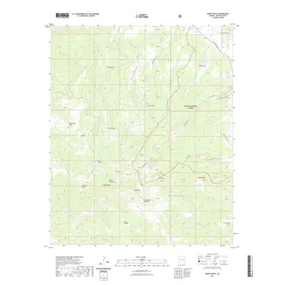
2021 Map of Mount Baldy
USGS Topo · Published 2021About this map
Baldy Peak and Mount Baldy South Peak dominate this high-elevation landscape within the Apache National Forest. This terrain is characterized by numerous alpine meadows or cienegas, including Hall Cienega, Smith Cienega, and Bonito Cienega, which serve as the headwaters for several significant drainage systems. The W Fork Little Colorado River and E Fork Little Colorado River begin their descent here, alongside the W Fork Black River and E Fork White River, illustrating the complex hydrology of the White Mountains. Historical land use is evidenced by the Railroad Grade Trl in the northeast, following the path of former logging or industrial transit. Peaks such as Mt Ord, Mt Thomas, and Mt Warren provide a clear view of the area's physical geography as it was documented in the early 21st century.
Find a feature on this map
60 named features on this map. Tap any name to fly to it.
Don’t see what you’re looking for? This feature index may not catch every label — zoom into the map to look around manually.
Map Details
Editions of this 2021 Mount Baldy Map
This is the sole edition of this map. No revisions or reprints were ever made.
Other maps of this area

1886 · St Johns
USGS Topo · 1:250,000

1892 · St Johns
USGS Topo · 1:250,000

1922 · Nutrioso
USGS Topo · 1:125,000

1954 · Clifton
USGS Topo · 1:250,000

1954 · Saint Johns
USGS Topo · 1:250,000

1957 · Clifton
USGS Topo · 1:250,000

1957 · Saint Johns
USGS Topo · 1:250,000

1958 · Clifton
USGS Topo · 1:250,000

1958 · Saint Johns
USGS Topo · 1:250,000

1958 · Big Lake
USGS Topo · 1:62,500