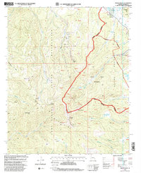
1997 Map of Mount Baldy
USGS Topo · Published 2000About this map
Mount Baldy and the surrounding high country of the White Mountains define this landscape, where the headwaters of several major river systems originate. The boundary between the Fort Apache Indian Reservation and the Apache National Forest runs directly through these peaks, including Baldy Peak and Mount Thomas. This high-altitude terrain is characterized by numerous springs and alpine meadows, such as Bonito Cienega and Pacheta Cienega, which feed the various forks of the Little Colorado River and the White River.
Find a feature on this map
62 named features on this map. Tap any name to fly to it.
Don’t see what you’re looking for? This feature index may not catch every label — zoom into the map to look around manually.
Map Details
Editions of this 1997 Mount Baldy Map
This is the sole edition of this map. No revisions or reprints were ever made.
Other maps of this area

1886 · St Johns
USGS Topo · 1:250,000

1892 · St Johns
USGS Topo · 1:250,000

1922 · Nutrioso
USGS Topo · 1:125,000

1954 · Clifton
USGS Topo · 1:250,000

1954 · Saint Johns
USGS Topo · 1:250,000

1957 · Clifton
USGS Topo · 1:250,000

1957 · Saint Johns
USGS Topo · 1:250,000

1958 · Clifton
USGS Topo · 1:250,000

1958 · Saint Johns
USGS Topo · 1:250,000

1958 · Big Lake
USGS Topo · 1:62,500