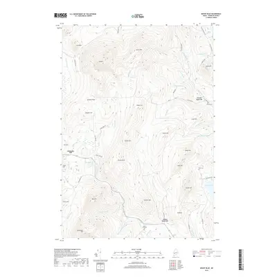
2018 Map of Mount Blue
USGS Topo · Published 2018About this map
Mt Blue and Spruce Mtn dominate the high ground of this Franklin County landscape, where the terrain transitions from steep ridges to the lower valleys of Temple Intervale and Wilton Intervale. The settlement at Hildreths Mill is situated along the upper reaches of Wilson Stream, highlighting the historical importance of water power in this upland region. Modern topographic data reveals a complex network of brooks, including Alder Brook and Temple Brook, that drain the surrounding summits like Kinneys Head and Saddleback Mtn. For local historians and genealogists, the map identifies several burial sites, such as the Intervale Cem and Adams Richardson Cem, which provide points of connection to the families who established farms and small industries along Varnum Pond and the surrounding hillsides.
Find a feature on this map
64 named features on this map. Tap any name to fly to it.
Don’t see what you’re looking for? This feature index may not catch every label — zoom into the map to look around manually.
Map Details
Editions of this 2018 Mount Blue Map
This is the sole edition of this map. No revisions or reprints were ever made.
Other maps of this area

1924 · Farmington
USGS Topo · 1:62,500

1926 · Dixfield
USGS Topo · 1:62,500

1929 · Phillips
USGS Topo · 1:48,000

1929 · Dixfield
USGS Topo · 1:62,500

1930 · Kingfield
USGS Topo · 1:48,000

1932 · Phillips
USGS Topo · 1:62,500

1932 · Kingfield
USGS Topo · 1:62,500

1950 · Lewiston
USGS Topo · 1:250,000

1956 · Dixfield
USGS Topo · 1:48,000

1956 · Farmington
USGS Topo · 1:62,500