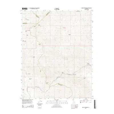
2015 Map of Mount Boardman
USGS Topo · Published 2015About this map
San Antonio Valley serves as a central point in this high-altitude landscape where the boundaries of four counties—Santa Clara, Stanislaus, Alameda, and San Joaquin—converge. The terrain is defined by a dense network of canyons and peaks, anchored by the prominence of Mount Boardman and Mt Mocho to the north and Red Mtn to the south. Historically significant routes like Mines Rd and San Antonio Valley Rd follow the natural topography, providing access to this isolated interior. Water sources are scattered throughout the drainages, including Passionate Spring and the headwaters of Del Puerto Cr. The map reveals a place where land management and ranching tradition persist, evidenced by the named valleys like Blackbird Valley and the remote Hideout Canyon, tucked away from the more developed coastal corridors of the region.
Find a feature on this map
41 named features on this map. Tap any name to fly to it.
Don’t see what you’re looking for? This feature index may not catch every label — zoom into the map to look around manually.
Map Details
Editions of this 2015 Mount Boardman Map
This is the sole edition of this map. No revisions or reprints were ever made.
Other maps of this area

1897 · Mt. Hamilton
USGS Topo · 1:62,500

1907 · Tesla
USGS Topo · 1:62,500

1913 · Romain
USGS Topo · 1:31,680

1916 · Romain
USGS Topo · 1:31,680

1922 · Carbona
USGS Topo · 1:62,500

1938 · Mt. Boardman
USGS Topo · 1:62,500

1942 · Mt. Hamilton
USGS Topo · 1:62,500
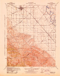
1942 · Carbona
USGS Topo · 1:62,500

1942 · Mt. Boardman
USGS Topo · 1:62,500

1942 · Altamont
USGS Topo · 1:62,500