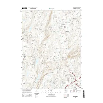
2015 Map of Mount Carmel
USGS Topo · Published 2015About this map
Mount Carmel and the surrounding ridgelines of south-central Connecticut define this landscape, where the Mill River carves a path through the valley towards Hamden. The terrain is marked by significant elevations like West Rock Ridge and Mount Sanford, which overlook a sophisticated network of water management systems including Lake Bethany, Lake Chamberlain, and the Farm Brook Reservoir. This 2015 survey illustrates a region where suburban development and academic life at Quinnipiac University coexist with older land uses, such as the Old Mill site and numerous family-named landmarks like Carrington Hill and Mad Mare Ridge. Local history is preserved in a series of community burial grounds, from the Central Burying Grounds in the south to Westwood Cemetery and New Saint Bridget Cemetery further north, documenting generations of settlement in places like Brooksvale, Centerville, and Bethany Wood.
Find a feature on this map
88 named features on this map. Tap any name to fly to it.
Don’t see what you’re looking for? This feature index may not catch every label — zoom into the map to look around manually.
Map Details
Editions of this 2015 Mount Carmel Map
This is the sole edition of this map. No revisions or reprints were ever made.
Other maps of this area

1889 · Derby
USGS Topo · 1:62,500

1891 · Derby
USGS Topo · 1:62,500

1892 · New Haven
USGS Topo · 1:62,500

1892 · Meriden
USGS Topo · 1:62,500

1893 · Waterbury
USGS Topo · 1:62,500

1893 · Meriden
USGS Topo · 1:62,500

1893 · Derby
USGS Topo · 1:62,500

1904 · Waterbury
USGS Topo · 1:62,500

1904 · Litchfield
USGS Topo · 1:125,000

1906 · Farmington
USGS Topo · 1:125,000