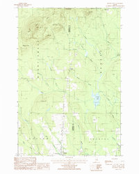
1986 Map of Mount Chase
USGS Topo · Published 1986About this map
Patten anchors the southern edge of this mid-1980s landscape, serving as a gateway to the northern Maine timberlands and the heights of Mount Chase. The terrain is defined by a series of prominent peaks, including Pickett Mtn, Bear Mtn, Davis Mtn, and Bald Mtn, which overlook a complex network of waterways such as Crystal Lake and Hale Brook.
Find a feature on this map
32 named features on this map. Tap any name to fly to it.
Don’t see what you’re looking for? This feature index may not catch every label — zoom into the map to look around manually.
Map Details
Editions of this 1986 Mount Chase Map
This is the sole edition of this map. No revisions or reprints were ever made.
Other maps of this area

1940 · Island Falls
USGS Topo · 1:62,500

1940 · Sherman
USGS Topo · 1:62,500

1942 · Island Falls
USGS Topo · 1:62,500

1942 · Sherman
USGS Topo · 1:62,500

1953 · Stacyville
USGS Topo · 1:62,500

1954 · Shin Pond
USGS Topo · 1:62,500

1954 · Presque Isle
USGS Topo · 1:250,000

1954 · Millinocket
USGS Topo · 1:250,000

1958 · Presque Isle
USGS Topo · 1:250,000

1958 · Millinocket
USGS Topo · 1:250,000