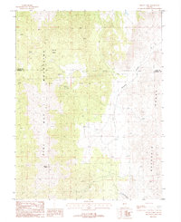
1987 Map of Mount Como
USGS Topo · Published 1988About this map
Mount Como towers over the high-altitude landscape where the Pine Nut Mountains meet the Buckskin Range in the late 1980s. This mountainous terrain is marked by numerous prospect locations and extensive mining activity, particularly concentrated near Sunrise Camp. The map documents the intricate network of unimproved roads and trails that traverse the steep ridges and basins, such as Sunrise Basin and Sunrise Pass, which provided access to remote operations.
Find a feature on this map
14 named features on this map. Tap any name to fly to it.
Don’t see what you’re looking for? This feature index may not catch every label — zoom into the map to look around manually.
Map Details
Editions of this 1987 Mount Como Map
2 editions found
Other maps of this area

1889 · Markleeville
USGS Topo · 1:125,000

1891 · Carson
USGS Topo · 1:125,000

1891 · Markleeville
USGS Topo · 1:125,000

1891 · Wabuska
USGS Topo · 1:125,000

1891 · Wellington
USGS Topo · 1:125,000

1893 · Carson
USGS Topo · 1:125,000

1893 · Markleeville
USGS Topo · 1:125,000

1893 · Wellington
USGS Topo · 1:125,000

1894 · Wabuska
USGS Topo · 1:125,000

1948 · Walker Lake
USGS Topo · 1:250,000